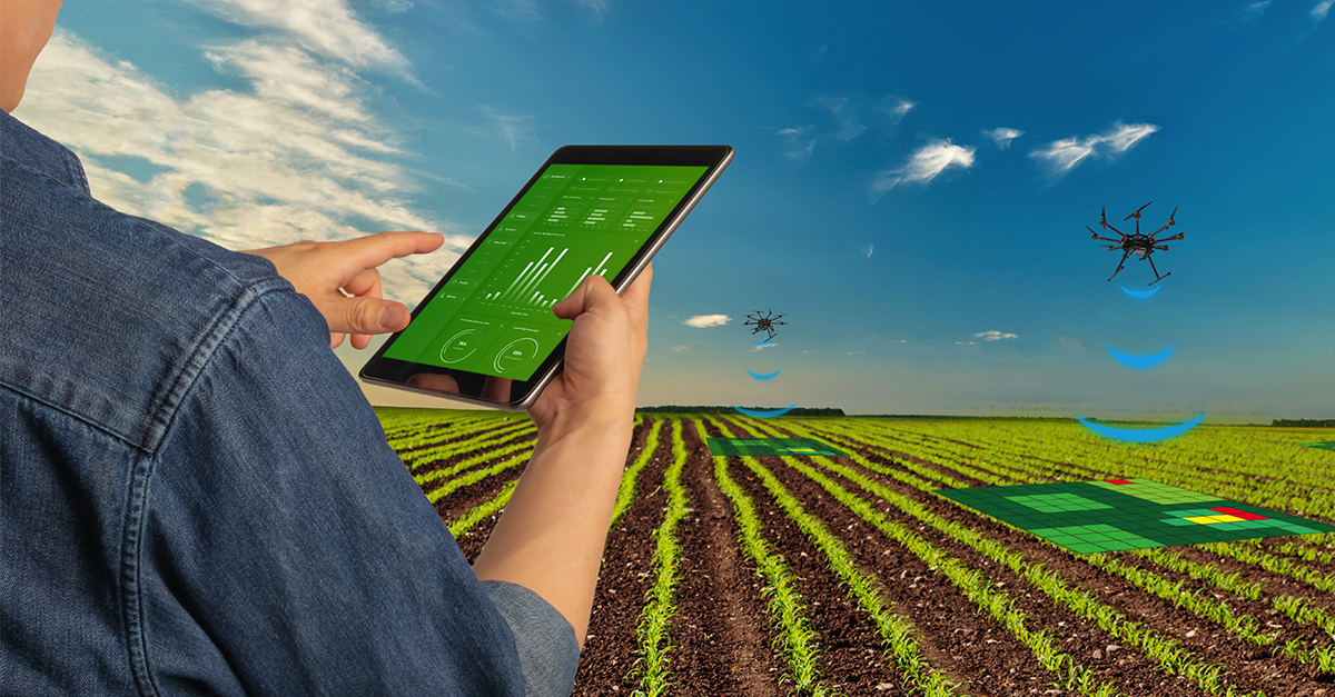
Crop Mapping
Using drones for crop mapping involves capturing aerial data to assess and monitor the health and growth of crops, aiding farmers in informed decision-making for better agricultural management.
Benefits Of Crop Mapping
INCREASED ACCURACY
Drones can help farmers to map their fields with great accuracy, allowing them to track the location and health of their crops. Mapping drone technology allows farmers to more accurately identify areas of their fields.
REDUCED CROP SURVEY COST
Drones can help farmers to map their fields with great accuracy, allowing them to track the location and health of their crops. Mapping drone technology allows farmers to more accurately identify areas of their fields.
INCREASED EFFICIENCY
Drones can help farmers to map their fields with great accuracy, allowing them to track the location and health of their crops. Mapping drone technology allows farmers to more accurately identify areas of their fields.
Using Drones
Challenges
- Data Processing and Analysis: Handling the large volumes of data collected by drones can be challenging.
- Resolution and Accuracy: Ensuring high-resolution imagery is essential for accurate crop mapping. Challenges arise in achieving the right balance between image resolution and the coverage area to capture detailed information.
- Weather Dependency: Adverse weather conditions such as strong winds, rain, or low visibility can impact drone flights, limiting the data collection window and affecting the quality of acquired imagery.
- Costs and Accessibility: Acquiring and maintaining drone technology, along with the associated software and expertise, can be costly. Ensuring accessibility and affordability for small-scale farmers is a challenge in some regions.
- Integration with Farming Systems: Integrating drone mapping data with existing farming practices and systems can be challenging. Farmers need user-friendly tools that seamlessly incorporate drone-derived information into their decision-making processes.
How Works
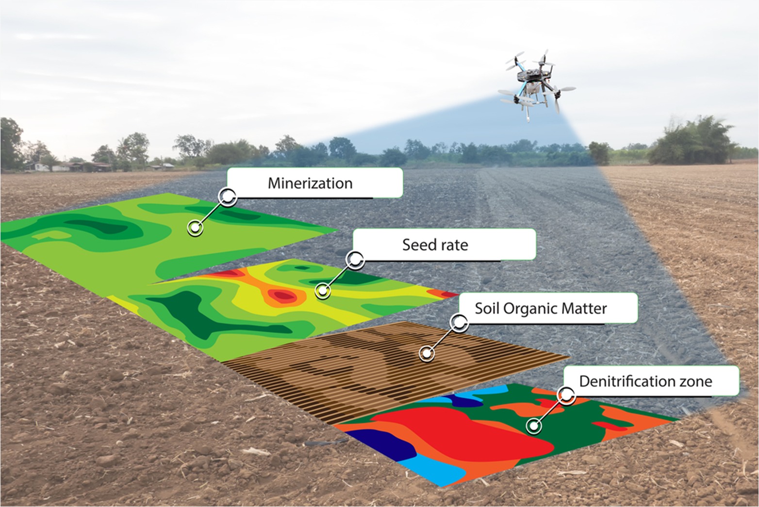
Data Acquisition:
Deploy the drone equipped with sensors, such as RGB (Red, Green, Blue) cameras, multispectral sensors, or thermal cameras. The sensors capture high-resolution imagery of the crops and the surrounding area during the flight. Drones can fly at various altitudes to capture different levels of detail.Data Acquisition:
Deploy the drone equipped with sensors, such as RGB (Red, Green, Blue) cameras, multispectral sensors, or thermal cameras. The sensors capture high-resolution imagery of the crops and the surrounding area during the flight. Drones can fly at various altitudes to capture different levels of detail.Image Capture:
The drone captures a sequence of images with significant overlap to ensure comprehensive coverage and accurate stitching during post-processing. Specialized sensors may capture data beyond visible light, such as near-infrared, to provide insights into plant health.
Explore More Content
Crop mapping with drones has revolutionized modern agriculture by offering a detailed and efficient way to monitor and manage crops. Drones equipped with advanced imaging technology, such as multispectral and thermal sensors, can capture high-resolution aerial imagery of fields.
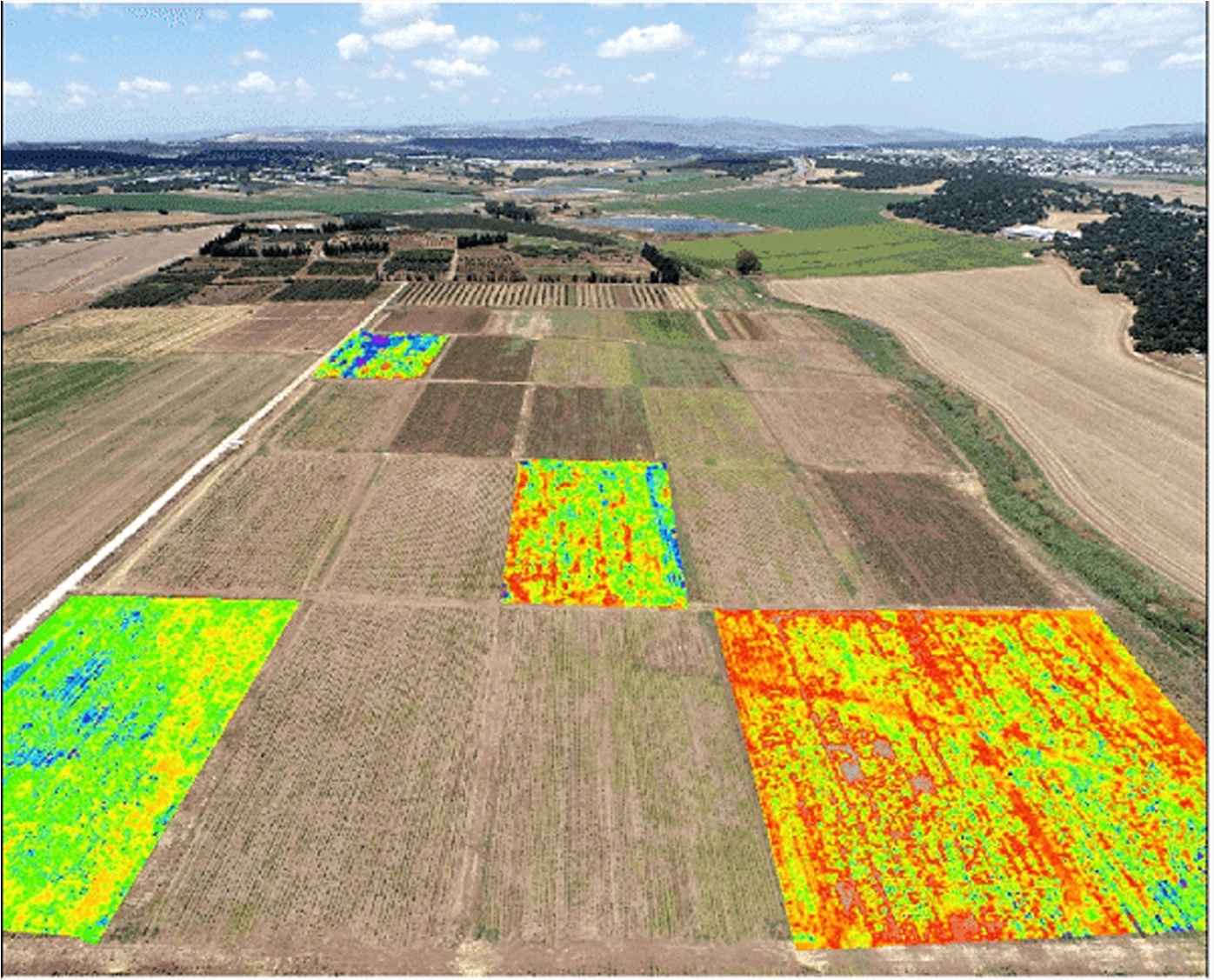
The benefits of drone-based crop mapping are substantial. These aerial surveys allow farmers to identify specific areas of concern, enabling targeted interventions like precision irrigation, pest control, and fertilizer application. By understanding the spatial variability within a field.
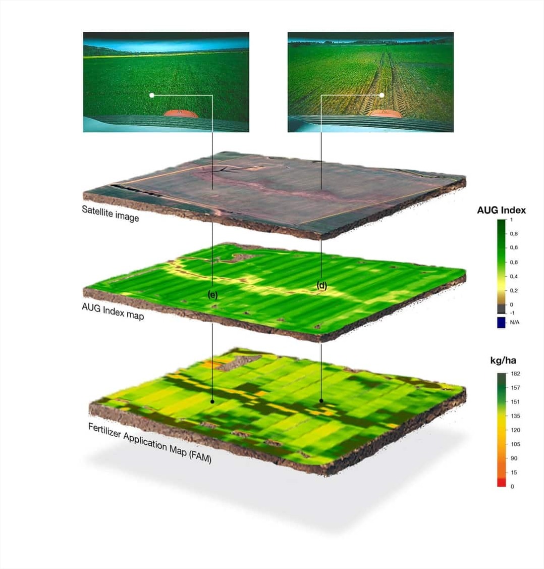
The real-time and accurate information obtained through drone mapping assists farmers in making timely decisions throughout the growing season.
crop mapping using drones empowers farmers with actionable insights, enhancing precision agriculture practices and contributing to sustainable and efficient food production.